2012年12月26日水曜日

ウクライナ

Ukraine(オリジナルはこちら)
 ウクライナ


Now also in. English for the first time on this blog!
さて、ここからは英語でもブログを書くという最初のエントリです。
(訳者注:翻訳作業に関して、当初はオランダ語で書かれたものを英語に機械翻訳して日本語に訳すという取り決めだったですが、前日の私にとっては屈辱的(笑)なエントリの後、遺憾の意とかミカンのミを込めて「蘭英Google翻訳がひどすぎるのでなんとかしれ!」という苦情を言ったらしぶしぶ書いてくれるようになった描き下ろし英語のエントリ一発目。これ以前のエントリについては、わざわざこの日以降に書き直してくれました。ただし、それでもイミフかつめちゃくちゃな場合が多いので、結局苦労は変わらないのでしたとさ。お互いの意思疎通がうまくいかんのは、私のプアな英語力のせいだけじゃないだろうよw。このままではメノーの言うとおり私が訳すより日本語に機械翻訳した方がわけわかるかもw。オランダ語の堪能な方に続きをお願いしたいような気がするです)

The next country is Ukraine.
The countryside in All which a part of the football World Cup has leg played last year.
An unknown country where I will go cycling.
次の国はウクライナ。
前回のワールドカップが開催された国の一つでもあります。
自転車を乗るという点では未知の国。

The language is very hard to understand for me Because it and has the Cyrillic characters.
This Became very clear when i received the three maps that i ordered over the Internet.
The scale is 1:500,000 and it does have 3 maps of the country and are very different with my planned itinerary (which has Latin words for the cities) in GPSies.com!
ウクライナの言葉はとてもむつかしい。というのもキリル文字だし。このことすらインターネットを通して、3つの(紙の)地図を受け取ってようやくわかりました。
50万分の1スケールで地図は3枚。これは当初私がGPSies.comで計画したときに使ったもの(ちゃんと都市名がラテン表記(アルファベット表記=ローマ字)だった)とは似ても似つかぬものでした!

However, I have to use the maps. Indeed, the GPS device and route is and will always be additional. The route will be collored on the map before departure in 2014.
けれども、私はこの(紙の)地図を使わなければなりません。実際、GPS機器のルートは補助的なものにすぎませんから。2014年の出発までには予定ルートを色づけるようにします。

Last weekend, I was using the website www.wereldfietser.nl  and came into contact with two people who have cycled around in Asia.
Wouter together with Paul, cycled by bike from the Netherlands to Shanghai!
The route they followed was certainly a different one than I want to follow. Their experience is very recent (2012) and highly valuable for me!
先の週末、私はwereldfietser.nlというサイトを利用し、アジアを自転車で回ったつわもの二人とコンタクトをとりました。
ワウテルとポールは自転車で、オランダから上海までを走破したのです!彼らの経験はごく最近(2012年)のことなので、私にとって大変価値があるのです!

I printed out Entirely Their blog and just read for the first time. Very nice and interesting!
  http://www.cycle2china.com
私は彼らのブログ全体をプリントアウトしまず読んでみました。とても面白くってためになるブログです!

Then the route I created:
そして私が作ったルートはこちら。

Below are the various sub maps from my planned route.
The roads are ranging from good to very poor, I understand from Wouter's story.
I expect it to be prepared by the Quest higher on the wheels turn (higher ground clearance) and very good tires. Also moderate the speed will help to Ensure That the route to ride can be done with the Quest!
以下はさまざまな計画ルートからのサブマップです。
ワウテルのブログからわかったことは、道は悪くはないものからとても悪いものへとなっていくということです。
クエストの最低地上高を調整するなどし、良いタイヤを装備し、備える必要があるようです。クエストでそうしたルートを走るためにはゆっくりと走ることも助けになることでしょう!

From the Polish border
ポーランド国境から
Along the Highway (!) On Into the Ukraine
高速道路(!)に沿ってウクライナに入る


Until the Russian border
ロシア国境まで

The distances and the expected climbing meters
走行距離(1,461km)と推定登坂高度累計(10,366m)

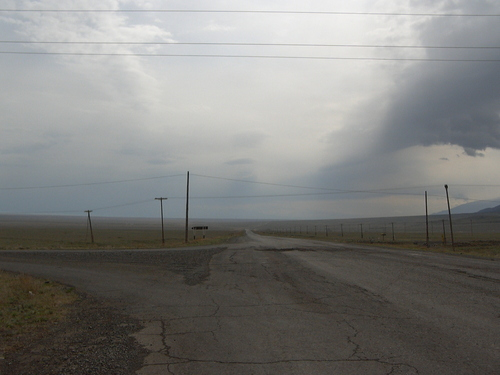
If I have to believe the stories, and I do, of course, the Ukraine is a very poor country with an infrastructure That is somewhat in decline. There is simply no money for that!
Also, the state of pollution of land and air is Particularly high.
There is a burning smell in the air and road sides are littered with trash.
Creating awareness of the environment has yet to Grow Substantially! Next blog entry will be about the route in Russia.
この話を信じるなら、当然私は信じますが、ウクライナの道路とインフラがお粗末な国です。単純に金がないのです。国の土壌や空気の汚染状況も特にひどいものです。
空気は焦げたにおいがし、道路わきにはゴミが散らかっています。
環境への意識をりあげることで、持続可能性をはぐくむべきです!次のエントリではロシアのルートについて記述します。

2012年12月10日月曜日

わがブログ日本語/英語版に?


 My blog in Japanese / English!?(オリジナルはこちら)
わがブログ日本語/英語版に?

A surprise that today I actually liked.
The promised translation of my blog in English Japanese! Once Ymte / Velomobile me with the Japanese rider of a Strada had connected, I started mail. That's a great experience! He speaks only Japanese and not much English. My (English) email is thus translated into Japanese. This translation is very poor quality and controlled me by Seidayu mailed an ambiguity. Today he sent the translation of my blog, please note in a real new blog http://n2j2014.blogspot.nl I'm stunned. Well what language errors, but I find it extraordinary that a Japaner want to do and actually put into practice! He recently drove from Gifu to Hiroschima and back with his Milan. 1000 km in 4 days if I understood him well! For me valuable local information on road conditions, slopes and pressed on such a route!
I will be glad if I could be in Japan during the meeting reminder of the atomic bomb on Hiroshima in August. It will be aanpezen, but I'm going for and have giant forward to it!
今日は、うれしい驚きがありました。
英語と日本語に私のブログが訳されることになったのです!以前イムテ(訳者注:ベロモービルQuestなどを製造販売するVelomobiel.nlの主な経営者の一人で優れた競技者でもある人物)を通して日本人のStrada乗り(訳者注:Seidayuことわたくしです)と連絡を取っていたのです!素晴らしいことです!かれは日本語しか話せないし英語力は充分ではありません。私の(英語による)電子メールはおそらく日本語に翻訳されています。Seidayuによる翻訳は、非常に品質が低く、彼によるメールのあいまいさは毎度煩わせます(訳者注:容赦ねぇなぁ(^_^;))。今日は彼がわがブログの翻訳を送ってくれたので、どうか真新しいブログ(当ブログのこと)をブックマークなどしてください。実際、私はあまりの間違いの多さに目を回しているのだけれど、いや、言葉の間違いなんてどうでもいいそれよりも日本人がこのブログを翻訳したがって、それを実行したってことが信じられないくらいすごいことですよね。彼の意味不明な発言を私がうまく理解しているとすれば、かれは最近岐阜から広島までを往復ミランSLで自走して1000kmを4日間で走破したのです!(訳者注:嘘です正確には5日間かかりました(^_^;)以前間違いを指摘したのにヤツは訂正する気ないらしいw)私にとっては貴重な場所の情報や道路状況、行程や坂道などの情報源です!
8月に広島の原爆記念日のセレモニーに参加できたらと考えています。それがこの旅の大いなる意義の一つになることでしょう!

2012年12月9日日曜日

ポーランド


Poland(オリジナルはこちら)
ポーランド

The third country I will go to and through, Poland!
A country I visited Earlier by plane.
On that occasion I did drive by car and did see That this country is less used to cyclists.
There are a lot of road casualties, due to the narrow roads, fast driving and alcohol while driving!
Also enforcement of the law is not very good.
行きて過ぎさる予定の3つ目の国はポーランドッ!
飛行機で訪れたことのある国です。
そんときは、車を運転したのですが、あまり自転車を使わない国に見えました。
狭い道路や、速度超過、飲酒運転により、たくさんの交通事故犠牲者がある国だったりもします。
遵法精神がイマイチ高くない国でもあります。

This will result in me:
Not cycling in the evening or night.
One or two flags on the Quest,
Driving with lights flashing when on a narrow and busy road!
これを踏まえ、私がするべきことは・・・・・・。
  • 宵や夜にはチャリ乗るな。
  • 一つ二つは旗立てろ。
  • 狭く混む道走るときゃ、ライト点滅させるべし!
といったところでしょうか。

Roughly the route from Gubin on the river Oder at the German border, Along the Westside of the Polish border south towards Krakow.
大まかなルートは、ドイツ国境のオデール川沿いにあるグビン(Gubin)からポーランド国境の西側に沿ってクラクフに向かって南下します。

There I will visit the concentration camp (during WW2) That Auschwitz and the day after a visit of the city Krakow itself.
クラクフ市自体の訪問後、(第2次大戦時の)アウシュビッツ強制収容所を訪れる予定です。

After synthesis resting days I will go East towards the Ukrainian border.
そうして観光を兼ねて数日休んだ後、ウクライナ国境に向けて出発します。


The link to the whole route through Poland is:
次のリンクはポーランド全体の予定ルートになります。

http://www.gpsies.com/mapFolder.do?id=13258

The total distance in Poland will be800 km and the meters are climbing (doubtful!) 4371 meters
ポーランド走破にかかる合計距離は800kmほどで、登坂予定は4371mにもなる予定です。

After the trip I will verify facts thesis with the real figures (GPS)
The landscape will be rolling / little hilly.
この旅の後、実際にはどれほどだったのかをGPS測定で確認したいところです。
地形は起伏に富んでいるというか、ちょっと山がちでしょう。

The language is Polish (of course) and nothing I know about languages ​​I can compare it with.
But non-verbal communication will always be possibleness
現地語は(もちろん)ポーランド語で、私は全く分かりません。替わりになりそうな言葉すら知らないし。
でもどんな場合でも、言葉以外の方法できっとわかりあえるでしょう。

The daily distances will be longer than 100 km a day.
In the mean time I made the entire route to Shanghai.
It will be 3500 km, All which I will cover in 4 months.
This Means That I will have to ride 110 km a day average (days without resting).
This Also Means I'll have to earn my resting days by making cycling days longer than 110 km in order to build up resting days.
走行距離は、毎日100km以上になるでしょう。
上海までの全行程はおそらく13,500kmにもなり、それを4カ月で走破する予定です。
これは(休みを入れない場合)平均110km/日で走行する必要があることを意味しています。
これはもちろん休日を作るためには、毎日110km以上を走る必要があるということです。 不可能ではないだろうけど、ちょっと刺激的です。 わくわくしてきました。(訳者注:書き下ろし英文にはないのですが、原文を英語に機械翻訳した個所にはそれっぽいのがありますので入れてみました。「なんだかオラ、わくわくしてきたぞ」的な感じでしょうか?)

2012年11月27日火曜日

ドイツ、2つ目の国

Germany, country number two.(オリジナルはこちら)
ドイツ、2つ目の国
From the Dutch German border I tried to find the route which is fairly flat towards the Polish border. North of the Hartz (low) mountain range and south of Berlin. At night I expect to do some stealth camping, camping in the woods and medows I find. During camp I will use "a tarp" to cover the Quest. I'll have That Already tarp and will find out how this will work out. Now I will give you a link to the total track or Germany.
オランダとドイツ国境からポーランド国境までは、とても平らな行程を探そうとしました。 北部ハルツ山地(Harzだとおもう)の低い山と南ベルリンまでの範囲です。 夜には森とか原っぱで、コッソリキャンプしようと思ってます。キャンプ中に私はタープによるカバーをクエストに使おうと思っています。 どうやったらそれをうまく使いこなせるかなど、試す予定です。 さあ、ドイツにおける予定行程をお伝えします。
http://www.gpsies.com/mapFolder.do?id=13595
Also some images of the separate parts of the total track
写真は全体の予定ルートを分割て載せています。


Germany to the Polish border
ドイツからポーランド国境

I do expect some "problems" in Germany. Cycle paths who can be high, bootable or not allowed to cycle on the road, forced to chose another route. All things I can deal with> If you have any experience with a velomobile in Germany, tell me your experience, it can help me. Also route changes, if you are known in the surroundings please let me know so I can change the route.
ドイツでは、いくつか問題が起こることを想定しています。自転車道路が高いところにあって、(押して歩くことはできるが)乗車できない場合、別の道を選ばなくてはなりません。 すべてを見込んでおく必要があります。 もし、どなたかドイツでベロモービルを利用した経験があれば、その経験についてお聞かせください。私の助けになります。 もちろん私の予定ルートに変更の必要がある場合は、ぜひお知らせください。
In the mean time I finished the route for China. Boy, I am so eager to start! The pictures of the route (Google Street View) are promising. I will write this later or on!
そうこうしているうちに、中国までのルートが設定し終わりました。嗚呼、出発が待ちきれなくなってきました! 上の行程写真(グーグルストリートビュー訳者注:たぶんストリートマップのことだと思うけど・・・・・・)はとてもよさげに見えます。それではまた!

2012年11月19日月曜日

日本への旅で、オランダにおける最初の部分


 The Netherlands the 1st part of the trip to Japan(オリジナル記事です)

Of course I start cycling in the Netherlands.
This part is ready to use.
In gpsies.com you can see how it shows.
もちろん私はオランダから、走り始めます。
この部分は準備できていますから、gpsies.comでみていただけますよ。
2nd part http://www.gpsies.com/map.do?fileId=gblmagkojoihfrlq
1st part http://www.gpsies.com/map.do?fileId=smmqdpkyxochtdye

Please comment on the route, good tips are always welcome!
I plan the route with as less climbing meters as possible. But if I have, I will climb every hill that is necessary.
I will definitely have to deal with hills and mountains after all along the way.
Also I will build up a good physical condition when I do these kilometers and hills I encounter.
I know climbing with a Quest will be harder, it weighs a more than a standard touring bicycle.
どうかこのルートについてコメントしてください。長旅のコツなどについてのコメントはいつでも大歓迎!
私はできる限り山登りを避けて走ることを計画しています。しかし、もし必要なら登るつもりです。
結局のところ、それらの山や丘を避けることはできないのです。
そうした場面に遭遇した時、肉体的なコンディションをよいものにするよう工夫するつもりです。
ベロモービル・クエストで山登りを行うことは大変だと知っています。ベロモービルは一般的なツーリング自転車よりも重たいのですから。

With my condor in 2008 its weight was more than 22 kg. A Quest will be about 10 kg more to start with.
On a journey like this, speed is not an issue at all, it’s more comfortable and easier with headwinds.
Climbing is something of a good gear ratio and steady paddle (or dabbling).
コンドル(Condor)による2008年の旅でも22kg以上の重さがありました。クエストはそれより、およそ10kg程度は重くなっています。
このような旅には、スピードの速さは全く問題ではありません。乗り心地の快適さや向かい風に対する適応性の方がより一層重要です。
山登りは適正なギアレシオの問題と確実なペダリングなどが重要になってきます。

I am searching for a good route without too many bends. These are hard with a Quest, this bicycle has a quite large turning circle.
私は曲がりすぎない適切なルートを探しています。ベロモービル・クエストは結構最小回転半径が大きいので(訳者注:5.5m以上)曲がることが不得手だったりします。

The first tryout of a screen print of the second half (of the Dutch part)
With a total climbing meters of 584 meters (??) and a distance of 117 km all the way until the German border.
最初のスクリーンショットの試みはオランダの後半部分からです。
登坂高度の累積は、584m(??)、距離は117kmで、この道を抜けると、ドイツ国境まで行くことができます。
The first half (of the Dutch part) is from Katwijk, which is a town at the North sea.

オランダの前半部分は、北部の海に面した町であるカトワイク(Katwijk)から始ります。

I thought it would be nice to start from the North sea (from sea to sea), this is only 107 km from my hometown!
The climbing meters are too high is my opinion. It is virtually flat as a pancake. 369 meters is way more than can be expected for this route.
私は北海からスタートすること(海から海まで)というのがいいだろうと思っています。わが町からここまでは、たったの107kmしかないですし!
ここは、登坂高度が大きすぎるというが、私の意見です。見た目はパンケーキみたいにまっ平らなのに、このルートには高低差369m以上と見積もられてしまっています。


Therefore I am reluctant to believe the climbing meters of the other countries with the GPSies website!
というわけで、私は他国の山道はGPSiesのサイトを信じる気になれません。
The tracks / routes I create in GPSies are NOT daytrips. Only the maximum number for the track (500) are leading in making that part.
It also gives me, next to the distance, a measure of climbing and descending of that part of the route.
Also it is quite handy if you have created this track, to know in which direction you have to leave the city! It’s always easy to go into a city, but often very hard to know the right way out of that same city!
私がGPSiesで作ったルート群は、日々の厳密な行程の連続ではありません。
作りうる最大数(500)のルート群は、なんとなくそのおおまかな一部を示すに過ぎません。
それは次の目的地に向けた登り坂の状況やとルートを示してくれます。
また、こうしておけば、どうやってこの街を出ればよいのか分かりやすくなるのです。
どんな時も大都市に入るのはたやすいのですが、適切な道順でそこから出ることは困難です。


With the tracks I know in which direction I’ll have to go on my route. Although the route isn’t solid, I can make an alternative way anytime, anywhere!

これまでの軌跡から、私はすすむべき方向を知るのです。ルートは固まったものではないので、いつでもどこでも柔軟に別ルートを探すことになるでしょう!
Well, another part of the trip is ready and on the blog.
さあ、この旅の別の個所について次のエントリの準備をしますね。

道の選択

Route choices

How do you go to?
What things you MUST bring and what (especially) leave home?

My journey with the Condor (Recumbent) in the U.S. and Canada has grown, with the TransAm as centerpiece and the rest of the route was attached later.
The TransAm is THE route from the East coast to the West coast or visa versa. Created in 1976 and evolved in the present route by the “Adventure Cycling Association'sThese bicyclemaps were already there and very useful for every cyclist.

Now everything is different.
The language, the German in Germany but after that, the languages I do not understand at all.
The written text in the countries I Also can not read.
All this makes the experience more intense.

The route I plan will be unknown.
I'll bring maps of the countries showing my drawn route.
The purchased maps of Ukraine gave a direct problem.
The cities were written in Ukrainian / Russian.
Before that I have much time to draw the route and places to recognize the signs on the road and surroundings.
Now I'm doing the routing in www.gpsies.com under the name “menno58”.
This route I created will give me a lot of support when I am on the road.
The GPS device will be on a big journey for the first time and will be of great help (I think)!
Only on the GPS maps (Inside the device on a Micro SD) will still be a problem.
This problem I am talking about is because Garmin micoSD are very expensive and not always available for the parts of the route I want to follow. Also the Micro SD cards are very fragile so I need spare microSD cards of the maps.
Meanwhile I discovered the site of http://www.openstreetmap.nl
The next time I will find out how to deal with the maps on this website.

Next to that, today I entered a new story of the plan on my blog.

 道の選択


どうやっていくのか?
何を旅に持っていくべきなのか?
また、何を家に置いていくのか?

以前私が経験したCondour(コンドル=リカンベントバイク)を利用したアメリカ・カナダ間の旅では、TransAmのルートを根幹にして行程を定められました。
TransAmというのは、東海岸から西海岸、またはその逆を繋いでおり、Adventure CyclingAssociation日本語のwiki)により1976年に作られ現在まで発展したルートです。
その自転車地図は、すでに完璧に用意され、多くのサイクリストたちに重宝がられています。


しかし、今回はすべてが違っています。
まず言葉。私はドイツ語が理解できません。
ドイツ語で書かれた文字も読めません。
ほかの国の言葉も理解できないでしょう。
これらすべてのことはより強烈な経験と考えています。

また、予定しているルートも未知のもの。
私は予定したルート描いた各国地図を持っていくつもりです。
購入したウクライナの地図は、直截的な問題をはらんでいました。
それはウクライナ語とロシア語で書かれており、予定ルートと場所を描いたり、道とその周辺につけられた記号を理解するまでに、結構時間がかかりました。
そのルートについてはwww.gpsies.comにて"menno58"で検索してもらえれば、ご確認いただけます。
これは後々大変役に立つと考えています。
というのは、私はGPSをこのような長距離旅行に使うのは初めてだからです。

地図についても問題があります。
これは私が購入したガーミンだけかもしれませんが、その地図がすべてを網羅していないうえに、大変高価なのです(しかも脆弱です!)。
その問題を解決するため私はこのサイト(オープンストリートマップ)を見つけました。http://www.openstreetmap.nl
次回、ここの地図をダウンロードして移動に使ってみようと思います。
(走行予定にない)余剰部分が多すぎることもガーミンのデメリットだと考えています。(ガーミンの地図それ自体が全部入りだということを、私は購入するまで知りませんでした。)

ベロモービルQuestで一日に走る距離については、見積もりが困難です。

現在私は一日当たり100kmから110kmを考えています。

条件さえ整えば、さらに距離は稼げるものと思っています。
アメリカではCondorを使って一日平均89kmを走りました。

もし予定が押してしまっていた場合、プレッシャーにさらされるでしょうから、
様々なケースを想定しておきたいと考えています。


写真は両方とも中国国境のアスタナからカザフスタンの道です。
環境や道路状況といったイメージを得る上で分かりやすい写真ですね

次回のエントリでは、簡単に各国について述べたいと思います。

2012年11月9日金曜日

新しいブログ 始めよう!

Friday, November 9, 2012


Start new blog!

Now the journey with my Carbon Quest increasingly definite shape starts to get, I start today 9 November 2012 a new blog.

Here I put the directly related information and claims of the big trip in 2014.

Never has a Velomobile used in this way and I'm very curious how it will actually go.

I have some experience in long bike trips with the recumbent.
In 2008 I drove in five months and one week nearly 11,000 km across the U.S. and Canada. A very inspirational journey now with another recumbent (now a wheel Quest!) From the Netherlands to Japan.
Because this time I do not want to fly, I will with the Trans Siberian Express travel back to the Netherlands.
In Japan I will Quest on a freighter set for his return.

The return of the Quest is unfortunately very expensive.
Therefore I will try to find a specific international sponsor advertising on the Quest.
This will get exposure to attention (which I will surely attract) of the press in the countries I by bicycle.

The route is still worked by me on www.gpsies.com The result so far in a distance of over 8700 km to the Chinese border. Elaboration of the route is mentioned in this blog as soon as it is ready. Optionally you the route tnt look at the above website under the name menno58.

In the course of time I will further elaborate many things as possible on a thematic basis.

 新しいブログ 始めよう!

さあ、新しいカーボンQuestとの2014年の旅について、徐々に形にしていきます。
ブログ開始日は本日2012年11月9日です。
このブログの趣旨は、この大いなる冒険に直接かかわる情報などを書き込むものです。

ベロモービルは、かつてこうした用途(大陸横断旅行)に供されたことはありませんから、私はどんなことになるかと大変わくわくしています。

私には、リカンベントバイクによる長旅の経験があります。

2008年に5ヶ月間と1週間かけてアメリカ・カナダ横断11,000キロメートルの旅を行いました。
とても気づきの多い旅で、今回は別のリカンベント=ベロモービル・クエスト(Quest)にてオランダから日本までの旅行を計画する運びとなりました。
今回私は飛行機を使いたくないので、帰路はシベリア鉄道を使ってオランダへ向かうつもりです。
日本からベロモービルQuestを貨物船で送るつもりですが、残念なことにそれは非常に高くついてしまいます。
そこで、私のベロモービルQuestの車体に広告を載せる国際的なスポンサーを募集しています。
これは私が訪れる予定の、多くの国々の報道機関の注目を集めることが予想されます。

予定ルートはwww.gpsies.comに表示させてあり、現在は中国国境より8700kmの位置までできています。このブログの内容と連動しています。menno58という名前で上記サイトを検索してもらえれば、確認できるはずです。

今後当ブログでは、このテーマに沿った情報を可能な限り詳しく発信していきます。